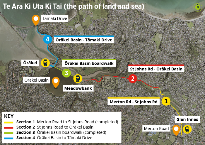
Overall project map: Sections 1–4
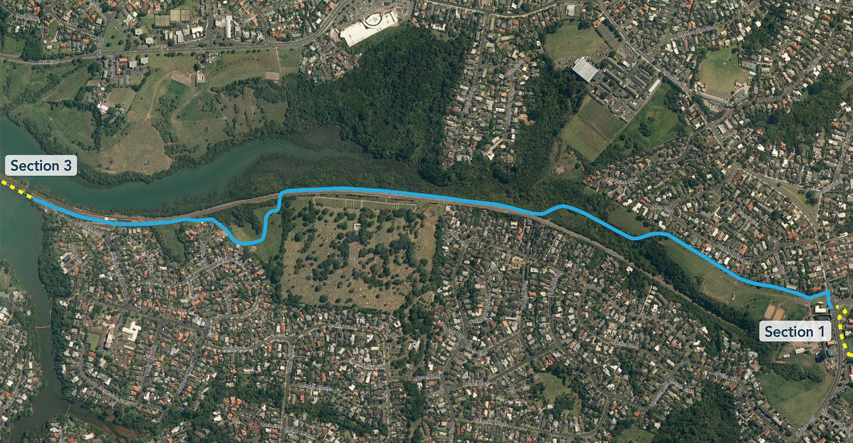
Section 2: St Johns Road to Ōrākei Basin
Design details
Cross sections
- Tahapa Reserve boardwalk [JPG, 221 KB]
- Meadowbank Pony Club [JPG, 160 KB]
- Mamaku Crescent [JPG, 234 KB]
![Tahapa Reserve boardwalk [JPG, 221 KB]](/assets/projects/glen-innes-to-tamaki-drive-shared-path/Cross-section-Section-2-Tahapa-Reserve-boardwalk-May-2020.jpg)
![Meadowbank Pony Club [JPG, 160 KB]](/assets/projects/glen-innes-to-tamaki-drive-shared-path/Cross-section-Section-2-Meadowbank-Pony-Club-May-2020.jpg)
![Mamaku Crescent [JPG, 234 KB]](/assets/projects/glen-innes-to-tamaki-drive-shared-path/Cross-section-Section-2-Mamaku-Crescent-May-2020.jpg)
Detailed information
Information about the alignment of the path, bridges and boardwalk, the location of lighting and rest areas and the planting:
- Landscaping plans [PDF, 12 MB]
- Route overview and location of artworks [PDF, 4.3 MB]
- St Heliers Bay Rd–St Johns Rd intersection [PDF, 2.1 MB]
- Kohimarama Rd to top of Pourewa Valley [PDF, 6.5 MB]
- Pourewa Valley to Tahapa Reserve East [PDF, 9 MB]
- Tahapa Reserve East and West [PDF, 5 MB]
- Meadowbank Station to Ōrākei Basin [PDF, 4.9 MB]
Purewa Road construction work - pedestrian access maps
Stage 1: 25–28 October 2022
Temporary adjustment on the northern footpath, pedestrians will be directed through the worksite for one week while the current pathway is altered to suit the second stage.
Stage 1 map [PDF, 541 KB]
Stage 2: 28 October – 7 December 2022
Pedestrians remain on the northern footpath, in the same location as currently. This allows work to be completed on the southern side of Purewa road in front of the new development building.
Stage 2 map [PDF, 522 KB]
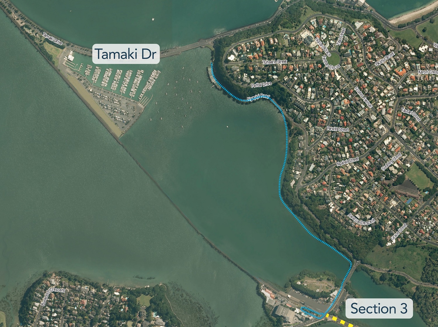
Section 4: Ōrākei Basin to Tāmaki Drive