Scam alerts: we’ve seen an increase in scam texts and emails claiming to be from us, asking for payments.
Check our example scams or report a scam to us

NZTA App: our mobile app provides a simple and secure way to access your driver licence and vehicle information.
Learn more and download the NZTA app

Project introduction

The Tauriko West project supports economic growth, productivity and housing development, improves safety, and provides a more resilient roading network.

  • Project type

    Road improvements
  • Project status

    Consenting, Design

Project updates

Subscribe to updates

What does subscribing mean? Please read our Privacy statement


Project overview

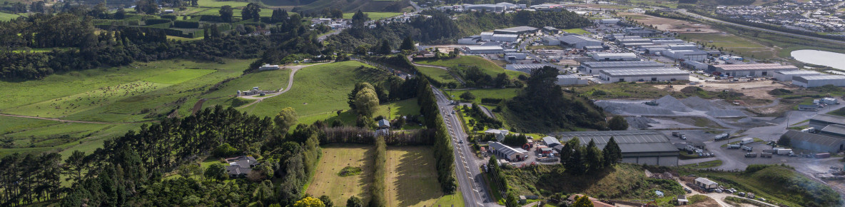
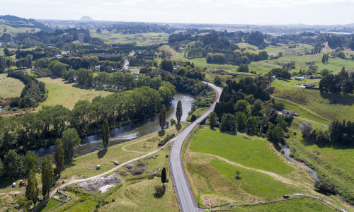
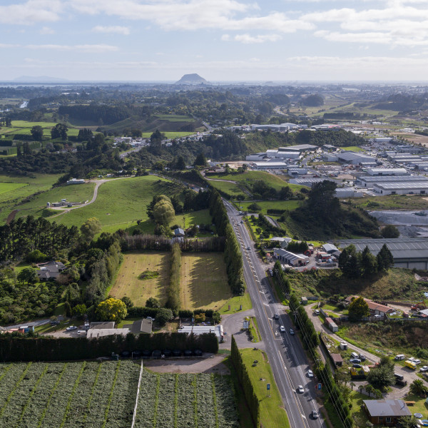
State Highway 29 and State Highway 29A form part of the wider Western Corridor, a significant growth area in the western Bay of Plenty. These roads are part of an already busy route, crucial for local communities, including residents, freight, and those travelling to and from Tauranga across the Kaimai Range. A route that needs to be safe and provide reliable travel times that are more predictable for everyone.

The key objectives of the Tauriko West project, a Road of National Significance, are to protect the strategic freight route, support a thriving and growing community, improve resilience and reliability, and safety for all users.

The Tauriko West project will be completed in 4 phases:

  • Ōmanawa Bridge replacement (SH29) – Replacing the Ōmanawa Bridge, realigning SH29 connections around the bridge and minor improvements to Ōmanawa Road Intersection (indicative timeframe: 2023/24 to 2027).

    SH29 Ōmanawa bridge replacement

  • Route protection for SH29 and SH29A – Designating, consenting and progressing property purchase so we’re ready to proceed with the detailed design and construction when funding is made available. This also protects the route from being built out in the upcoming development of the area (indicative timeframe: 2024/25 to 2028/29).
  • SH29 offline – Constructing a new 4-lane SH29 from north of Ōmanawa Bridge connecting to Takitimu North Link Interchange including Takitimu Drive Toll Road, and revocation of the existing SH29 (design and construction indicative timeframe, subject to funding 2028/29 to 2034/35). 
  • Widening existing SH29A – From Takitimu Drive Toll Road to Barkes Corner and a new interchange at Barkes Corner (design and construction indicative timeframe, subject to funding 2031/32 to 2038/39).

  • Project benefits
    • Improved journey time, reliability, and reduced congestion for people and freight supporting economic growth and productivity.
    • Supporting 3600-4000 new homes, Tauriko Business Estate extension, and potential development of 18,000 homes in the Western Corridor by 2063.
    • Reduced crash risk at intersections connecting state highways and local roads.
    • Predictable travel time for road users, reducing potential frustrations during unexpected delays.
    Close
  • Key features

    The transport improvements include:

    • An upgraded Ōmanawa Road Intersection and new 2-lane highway between Ōmanawa Road and Redwood Lane.
    • New 4-lane SH29 from Redwood Lane to the new Takitimu North Link Interchange, with overbridges at Tauriko Village and Cambridge Road.
    • A new interchange at Redwood Lane and Kaweroa Drive, continuing to provide access to Tauriko West and the Tauriko Business Estate.
    • A new interchange at Takitimu Drive Toll Road, connecting SH29, SH29A, and SH36, and upgrades to the Takitimu Drive roundabout.
    • Existing SH29A widened to 4 lanes from Takitimu Drive Toll Road to Barkes Corner.
    • A new interchange at Barkes Corner, which will separate traffic on Cameron Road and Pyes Pā Road from through-traffic on SH29A.
    • Existing SH29 retained as local road between Redwood Lane and Takitimu Drive Toll Road, with a small realignment and extension to connect with the Redwood Lane Interchange.
    • A new walking and cycling crossing at Barkes Corner providing safe access across SH29A, and walking and cycling connections at Redwood Lane, Cambridge Road and Barkes Corner providing safe access across SH29.
    • The preferred option will integrate with the Tauriko Enabling Works, retaining the upgraded intersections with traffic signals to be constructed at Cambridge Road and Tauriko Village, and the roundabout at Redwood Lane (as part of the new Redwood Lane Interchange).
      Tauriko Enabling Works project

    The upgrades have been refined through the investment case process, aligning with the RoNS standards and in accordance with the GPS 2024.

    Close
  • Next steps/timeline

    Now until 2028/29

    Route protection – During this phase, we’ll be designating and consenting the project (identifying the land we need and gaining statutory approvals), undertaking specimen design, completing geotechnical investigations, relocating utilities and progressing conversations with landowners. This phase gives landowners and the community certainty of the route and ensures NZTA is best placed to move forward when funding for design and construction becomes available. It also protects the route from being built out in the upcoming development of the area.

    May 2025

    Request for tender for a consultant to support us with the route protection activities.

    July 2025

    Route protection tender award, with the completion expected 2028/29.

    Late 2025

    First phase of construction to start on the Ōmanawa Bridge replacement.

    SH29 Ōmanawa bridge replacement project

    Close
  • Project background
    • SmartGrowth, through the Connected Centres Programme (Urban Form and Transport Initiative (UFTI)), identified the Western Corridor as a priority development area.
    • NZTA has worked with partner organisations (Tauranga City Council, Western Bay of Plenty District Council, Bay of Plenty Regional Council, Te Kauae a Roopu, SmartGrowth) since 2017 with the establishment of the Tauriko for Tomorrow project.
    • Tauriko for Tomorrow is a collaborative project driven by 4 key partners, Western Bay of Plenty District Council, Bay of Plenty Regional Council, Tauranga City Council, and NZTA – focussing on development in the Tauriko West area. The vision for Tauriko West is to create a thriving community that allows people to live, learn, work, and play locally. This means creating a new community and ensuring it has access to amenities such as schooling, parks, cycle and walkways, the Wairoa River, shopping at nearby areas and transport options and infrastructure.
    • The required transport network improvements were first identified in 2013 and in 2016 a programme business case confirmed the need for change and investment.
    • The Tauriko Network Connections Detailed Business Case was approved by the NZTA Board in August 2023. The DBC outlined the future transport improvements to Tauranga's Western Corridor; SH29, SH29A and SH36.
    • The Tauriko West improvements have been realigned to GPS 2024, prioritising economic growth and productivity, particularly the movement of freight. Aligning NZTA projects to GPS 2024 is required to give effect to the Government’s priorities for land transport and subsequently to secure funding for further stages including detailed design, consenting, property purchase and construction.

    Smartgrowth - The Western Bay of Plenty Transport System Plan(external link)

    Tauriko for Tomorrow project(external link)

    Tauriko Network Programme Business Case [PDF, 5.4 MB]

    Tauriko Network Connections Detailed Business Case [PDF, 6 MB]

    Close