Scam alerts: we’ve seen an increase in scam texts and emails claiming to be from us, asking for payments.
Check our example scams or report a scam to us

NZTA App: our mobile app provides a simple and secure way to access your driver licence and vehicle information.
Learn more and download the NZTA app

Project introduction

Our plan for SH1 Cumberland Street and SH88 St Andrew Street aims to improve safety, ensure improved access for everyone including emergency services, and strengthen links to the central city while keeping SH1 flowing efficiently.

  • Estimated project dates

    Jun 2025–Jun 2030
  • Project type

    Safety improvements
  • Project status

    Investigation

Subscribe to updates

What does subscribing mean? Please read our Privacy statement


About the project

The New Dunedin Hospital (NDH) and its outpatient facilities, currently being built in the central city, will change how people move through and experience this part of Dunedin. It offers a timely and exciting opportunity to reshape the surrounding transport infrastructure to better serve the community.

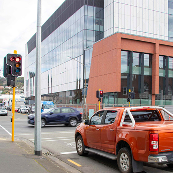
The main NDH inpatient and outpatient public entrances will open onto the SH1 Cumberland Street/SH88 St Andrew Street intersection, making both roads critical for hospital access. Both roads also have a vital role in moving people and goods across the city and beyond. 

Working with the Dunedin City Council (DCC), we’ve developed a proposal for the SH1/SH88 St Andrew Street area to make it safer and easier for everyone, including emergency services, to reach the hospital. Other benefits include improved connections with the central city while keeping SH1 running smoothly and efficiently.  

Because SH88 St Andrew Street runs between the NDH outpatient and inpatient buildings, its role in the city’s transport network needs to adapt. When the hospital opens, up to 10,000 pedestrians, including vulnerable people, will walk between and around these health facilities each day. We also need to make sure this road provides good access for emergency services and people using the drop-off and pick up areas as efficiently as possible. 

Here, you will find our proposed changes to roads around the NDH area. To make sure we have got it right, we are asking for feedback from the community and key stakeholders. Achieving the best safety, access, and efficiency outcomes means rethinking how both SH1 and SH88 are used. While these changes may bring new ways of moving through the area, we believe it is an opportunity to create safe and easy ways for people to access our modern health hub.

SH1-SH88 intersection visualization

View a larger version [JPG, 453 KB]

Your feedback matters

We want to hear what you think of our designs. It's easy – just complete our on-line feedback form survey:

Feedback form(external link)

Your ideas and feedback will help us get this project right, so it delivers safe, convenient, and efficient connections to our new hospital hub.

If you have questions about the project, email us at SH88StAndrewSt@nzta.govt.nz or send them NZTA, PO Box 5245, Dunedin 9058

Printed information about the project and feedback forms are available at Dunedin libraries and services centres

Feedback closes on Monday, 28 July 2025.

Snapshot of the key proposed changes

  • New Barnes Dance crossing (where all pedestrians cross the road at once) at the SH88 St Andrew Street/SH1 Cumberland Street intersection to help people reach the hospital public entrances safely.
  • Remove the westbound right turn from SH88 St Andrew Street onto SH1 Cumberland Street to make space and time for the increased number of pedestrians, including people with mobility needs, to cross the road.
  • Two new signalised pedestrian crossings on SH1 outside the Woolworths and the Centre City New World supermarkets.
  • Changes to St Andrew Street and other nearby streets to help people driving, walking and cycling, and emergency vehicles, move safely and smoothly around the hospital and surrounding area.
  • Left in and left out only turns are proposed to increase safety at the St Andrew/Leith Street and Frederick/Leith Street intersections.
  • Move SH88 from St Andrew to Frederick Street.
  • Timing - we aim to deliver this work over the next 2–5 years, depending on funding and consents.

The proposed plans for the SH1/SH88 area build on our earlier work in 2023, when the decision was made to keep the existing Dunedin SH1 one-way system. Find out more here:

Shaping Future Dunedin Transport

New Dunedin Hospital(external link)

Interactive map

This interactive map highlights our proposed changes. Click on the symbols to see these for each area.

SH1/SH88 Dunedin Safety Improvements interactive map(external link)

Key proposed improvements

Below are more details about our key proposed improvements.

  • SH1 from Stuart to Hanover Streets

    Mid-block signalised pedestrian crossings are planned on SH1 at the New World and Woolworths supermarkets. These provide a safe way to cross this busy road to the hospital’s mid-block entrances. Without these, people could put themselves in danger by crossing SH1 mid-block.  

    • These new crossings will be synchronized with the ‘green wave’ traffic flow signal system that keeps traffic moving efficiently on SH1 through central Dunedin. They will be similar to the one that has been successfully operating on SH1 outside the Toitu Museum for the last five years.
    • Some car park and bus stop changes are needed to make space for these mid-block crossings.
    • We also want to create longer parking spaces, so people can drive straight in, reducing the need to reverse into parallel parks against heavy traffic flows. This would improve traffic efficiency and people’s safety.  
    • We are keeping the north bound leg of the SH1 separated cycle lane, so people can continue biking through this area safely. 
    • These changes result in a net loss of eight car parking spaces and three bus stops.

    View larger version of the image [PDF, 1.7 MB]

    Close
  • St Andrew Street

    A Barnes Dance Crossing (where all pedestrians cross together) is planned on the SH1 Cumberland and St Andrew St intersection. This will give much safer and easier access to the NDH public entrances.  To make time and space for the crossing to run safely, we are proposing to stop right turns from St Andrew Street onto SH1 for westbound traffic.  

    • Other options to keep this right turn were considered, but in the end removing it was the only practical way to give pedestrians enough time to cross safely at the Barnes Dance and still give people driving coordinated green signal time as they move along the State Highway network, to keep traffic flowing.  If this change goes ahead there are still plenty of nearby routes to get onto SH1 and to the Western part of the central city.

    View larger version of the map [PDF, 143 KB]

    With the potential removal of the right turn from St Andrew Street onto SH1 north, Hanover and Frederick Streets are expected to become key alternative routes for light vehicles. We expect larger trucks to use Ward Street and the overbridge onto Frederick Street as an alternative route. Our traffic modelling shows these nearby roads can handle the small increase in traffic created by this change and travel times are only increased by a few seconds.

    Changes in traffic volumes: 

    • Frederick Street currently has 1,100 vehicles per hour at peak times. About 80 extra vehicles are expected per hour (or just over 1 per minute) 
    • Hanover Street currently has 500 vehicles per hour at peak times. About 60 extra vehicles are expected per hour (or around 1 per minute) 
    • Ward Street currently has 550 vehicles per hour at peak times. About 40-50 articulated trucks currently turn right at St Andrew Street between 7am and 7pm (an average of 4 vehicles per hour), which would be expected to divert to the Ward Street route.

    To minimise disruption and keep traffic flowing smoothly:

    • All alternative routes offer good connections to SH1 north, and we expect travel times to remain about the same, depending on the time of day and where people are driving to. Trips in peak traffic are likely to be a slightly longer on the Hanover, Frederick or Ward Street routes compared to the St Andrew Street route.
      • We have planned minor improvements to the alternative routes – see key changes below.
      • Clear signage on key approaches like Ward Street to give drivers plenty of advance notice and guide them to the best alternative routes.
      • Traffic signals on these alternative routes will be regularly monitored and adjusted to improve flow where needed.

    To keep traffic flowing smoothly, we are also proposing to make Frederick Street into the new SH88. Moving right turning traffic from St Andrew Street to Frederick Street will encourage heavy freight vehicles away from the hospital. This and the other initiatives will encourage heavy freight vehicles to use the Harbour Arterial/Ward Street bridge route, and light traffic to use Anzac Avenue, as these routes will be better suited to their journey. This will in turn help create a quieter, safer environment around the NDH. 

    We understand any change to familiar driving routes may cause some initial confusion. However, it usually doesn’t take long for people to adjust and form new habits, especially with clear signage and guidance in place.

    View larger version of the image [PDF, 1.7 MB]

    Note this and other the turning changes in this proposal will require amendment of the NZ Transport Agency (Traffic Controls on State Highways) Bylaw 2017 under s22AB of the Land Transport Act 1998.

    Close
  • Other changes on St Andrew Street

    At the Leith Street/St Andrew intersection, we are planning to allow only left turns in and out (except for emergency vehicles). This will stop risky right turns across two busy lanes of traffic.  

    We are making some parking changes on the north side of St Andrew Street near the Dunedin Central Fire Station. This will allow for traffic lane improvements, for better vehicle flow and more road space for drivers to pull over into the road shoulder for the many emergency service vehicles using this east-west city link. This change would see the loss of 14 parks, although this would be partially offset by new parks in nearby Harrow Street.

    View larger version of the map [PDF, 147 KB]

    DCC are investigating opening the Ward Street entrance into the St Andrew Street carpark, so it is easier to access for people wanting to park and are also reviewing zoning and pricing of car parks in the central city.

    Close
  • Anzac Avenue rail crossing intersection
    • We are planning improvements at the St Andrew Street/Anzac Avenue rail crossing to help traffic flow better, especially for drivers turning right onto Anzac Avenue from St Andrew Street.  This includes providing more green signal time. 
    • Kerb buildouts added at the St Andrew Street/Anzac Avenue intersection will make it easier and safer for people to cross the road.
    • These improvements will make it safer for people to walk to the large St Andrew Street carpark adjacent to the railway. Because of its location it is expected to be a popular parking choice for those travelling to the NDH and nearby central city.

    View larger version of the image [PDF, 1.7 MB]

    Close
  • Harrow Street

    Changes to St Andrew Street may lead to more drivers using Harrow Street as a shortcut to Hanover Street, which could raise safety concerns.

    • Our plan will simplify the road layout making it safer and easier to use for both drivers and pedestrians.  
    • The changes will free up space for 7 new angle parks overall.

    View larger version of the image [PDF, 1.7 MB]

    Close
  • Frederick Street
    • Frederick Street will continue to serve as a key freight route and shifting SH88 here is expected to have minimal impact, while offering better connections to SH1 north and south.
    • The right turn lane into SH1 north will be extended to improve traffic flow and reduce delays.
    • A pedestrian refuge will be installed near Leith Street to make walking and biking safer, without slowing traffic.
    • Left in, left out access will be introduced at Leith Street to improve safety and reduce turning conflicts. 
    • Kerbs will be built out and intersection limit lines moved forward at side streets to improve visibility and make it easier for drivers to enter Frederick Street.
    • Parking will be rearranged to fit the new road layout, with as many spaces retained as practical (between 13 and 16 parks will need to be removed to support all these changes.) Most of the parks removed are in the block between the SH1 one-way pair to improve traffic efficiency.
    • If SH88 is officially moved to Frederick Street, NZTA will manage this route, while DCC will manage St Andrew Street and Anzac Avenue. We will work together to get the best outcome for the city.

    Leith Street/Frederick Street intersection

    View larger version of the image [PDF, 1.7 MB]

    Close