A highway recognised by the government as a road of national significance, the Tauranga Eastern Link (TEL) is the Bay of Plenty’s largest roading project and a key strategic transport corridor for the region.
The $455 million Tauranga Eastern Link project was the Bay of Plenty's largest roading project at its completion date in 2015.
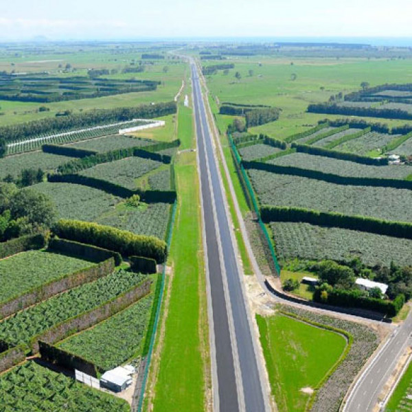
Tauranga Eastern Link begins at Te Maunga (near Baypark Stadium) in Tauranga and follows its existing route to the Domain Road intersection with State Highway 2 at Papamoa. It then leaves the current state highway route and crosses rural land parallel to Tara Road, across Parton Road and along the sandhills to the Kaituna River at the end of Bell Road. At this point the highway crosses the river and carries on past the Kaituna Wildlife Management Reserve. It heads south east across dairy farms and orchard lots before rising up over the railway line to join the existing junction of State Highways 2 and 33 (the Rotorua and Whakatane highways) near Paengaroa.
CloseThe $455 million Tauranga Eastern Link project delivers significant local, regional and national benefits.
The Tauranga Eastern Link will be a tolled highway - providing travel time savings and safety benefits of free-flow traffic.
During 2009, public were consulted on whether they supported Tauranga Eastern Link being a toll road so construction could start up to ten years earlier.
Tolling received significant community support (92% both conditional and unconditional) and as a result, NZTA submitted a tolling proposal to Cabinet. In July 2010 Cabinet approved the route could be tolled and construction has started.
For more information about the tolling consultation please view the following documents: