- Kia ora
- Understanding our project from above
- Blessing our new roads
- The visible impact of earthworks
- New traffic management truck based in Ōtaki
- Upcoming construction milestones
 Kia ora
It’s probably worth starting this project update by introducing myself. I took over the reins at PP2Ō from Andrew Goldie in early May, just as we’d come out of the COVID-19 lockdown, which was certainly an interesting time to start a new job. I’ve been living on the Kāpiti Coast for six years now, having previously been up in the Bay of Plenty, and it’s great to be working on the project, knowing the benefits it will bring to the local community.
The COVID-19 lockdown couldn’t have come at a worse time for us as we’d normally be finishing certain activities in April/May, ready for the winter months, and we missed good construction weather in April. We did carry out ‘essential services’ during the lockdown, but with only 350 man-hours recorded this April (as opposed to nearly 40,000 man-hours last April) it has challenged our construction programme. However, after being the first major project in the country to be given the all clear to re-mobilise back to site, we are almost back to normal and making steady progress, even with the wet month we’ve just had. Our focus now is to maximise this progress and prepare for the upcoming summer season.
We have completed the reinforced earth wall on the eastern side of Bridge 9 near Marycrest and are now building the reinforced earth wall on the western side, which will become very visible over the coming weeks. This bridge will take the Expressway up and over the railway line. We’re also making good progress on the earthworks and pavements south of Ōtaki Gorge Road.
I’ve really enjoyed my first couple of months on the project and I look forward to meeting you all over time.
If you need any further information on the PP2Ō Expressway project, please call us on 0800 PP2O INFO or email pp2o@nzta.govt.nz
Ngā mihi
Chris Hunt, Project Director
Understanding our project from above
Surveying has long been a vital part of the construction industry. This work involves examining and recording the features of a piece of land to produce maps, plans, or detailed descriptions.
Determining three-dimensional positions and angles of relative points on the surface of the area can be extremely time-consuming. So, it’s an exciting we can use new technologies to get the job done faster.
On the PP2Ō project our Surveyors have been using the latest drone technology to collect accurate 3D information on our site. Aerial shots are taken from 60 meters in the air and imported into a software programme called Pix4D, where the team can calculate data more precisely.
However, flying a drone on-site means certain procedures must be followed.
“You need to obtain a drone certification before taking to the sky,” says Fletcher’s Survey Manager Mark Fleming, who has more than 20-years’ of industry experience.
“And you always need to make sure that you are accompanied by a spotter who can assist with keeping an eye out for any helicopters or planes when the drone is airborne. The Ōtaki Airstrip is a few kilometres away from our project, and we need to specifically look out for any air traffic coming and going to the Aerodrome.
“The drone flight itself is simple.”
Mark sets the GPS coordinates up by physically placing black and white checkerboard Ground Contact Points (GCP) on either side of the flightpath. The drone, which can easily spot the markers from the sky, is flown up to the desirable height, and towards the first GCP, with Mark monitoring the visuals on a separate handheld device.
Using this technique, flight time is around 15 to 20 minutes per area. Incredibly, just five years ago, it would have taken around two days to collect the same data.
In the past, surveyors spent hours on-site physically measuring locations with GPS receivers. Today, their time spent on-site includes an element of fun whilst reaping the benefits of extremely accurate 3D data.
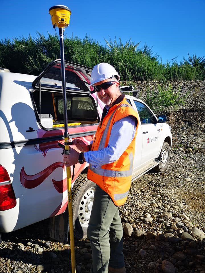
Survey Manager Mark Fleming.
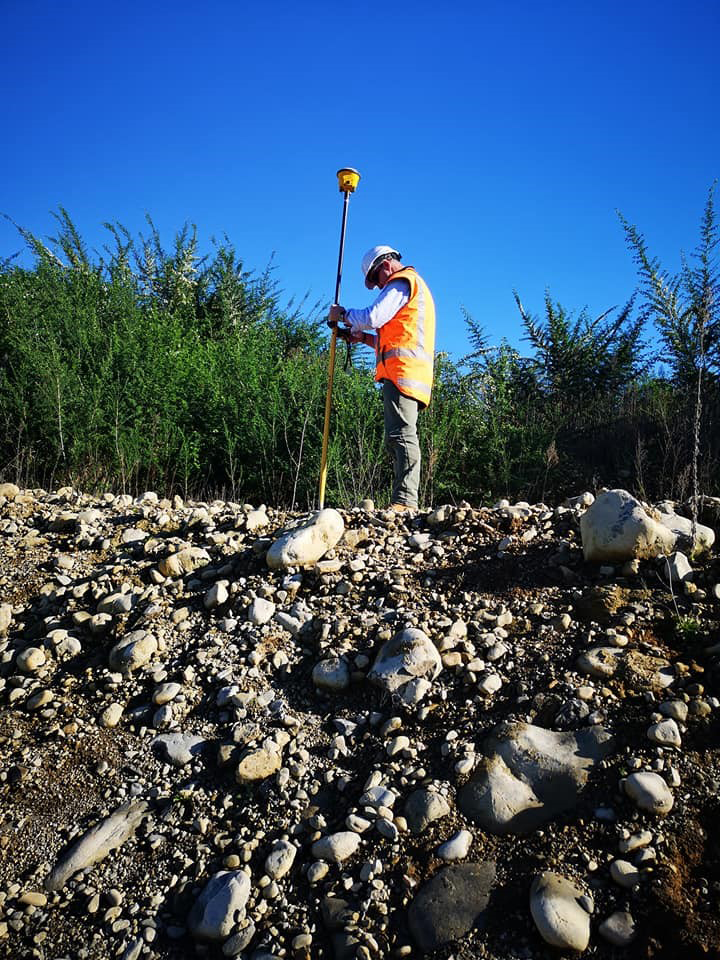
Setting up the GPS coordinates for the drone flight.
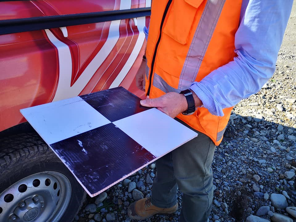
Black and white checkerboard GCP.
Blessing our new roads
For Ngā Hapū o Ōtaki the safety of our roads and the people who travel upon them is of utmost importance, which is one of the reasons why a karakia (blessing) is performed before any new roads are opened. But a karakia is about much more than invoking protection and guidance for travellers. These events have a far greater spiritual meaning for iwi that includes honouring their ancestors.
The PP2Ō project Kaiarahi, Rawiri Rikihana, recently led karakia for the stage 1 Local Arterial Road at Marycrest, the Old Hautere Link Road and the new access roads under the Ōtaki River Bridge.
He explains the significance of the karakia.
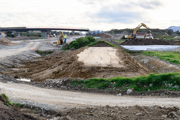
The visible impact of earthworks
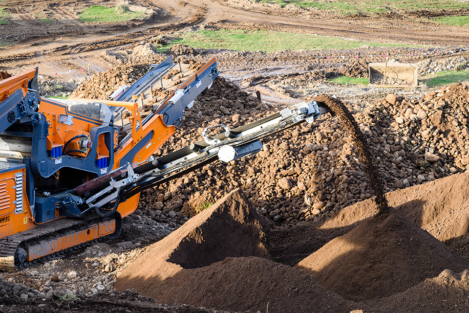
RX-555 Screening Plant sorting materials by size.
Building the PP2Ō Expressway through some of the North Island’s most beautiful countryside meant we needed to consider how to respect the land while disturbing it. From Peka Peka to Ōtaki, the area is dotted with lifestyle blocks that are wonderful for farming. The rich soil and wealth of geomaterials in these parts make the ground especially suited for agriculture.
On the PP2Ō project, earthworks play an enormous part in getting the Expressway completed, but the logistics involved are very complex and extensive.
“Bulk earthworks mean removing, moving or adding large quantities of soil or rock from one area to another, in order to make that area a suitable height and level for pavement construction,” explains Civils Manager Richard Rakovics.
In the pre-planning phase of PP2Ō, our Geotech Engineers did multiple studies to determine what types of soil materials we would find in the area. This meant civil engineers could start planning/developing the necessary earthworks implementation plans.
The Winiata Borrow at Te Horo is an example of a large piece of land next to State Highway 1 being utilised for bulk earthworks. It is also the most visible to the public, as they pass by on SH1. Impressive machinery like the RX-555 Screening Plant, which is used to classify materials by size, boldly takes its place amongst the giant diggers.
It is expected the total quantity of earthworks for PP2Ō will be 2.2 million m3. This amount will consist of structural cut/ fill volume of 1.5 million m3, 500,000 m3 of unsuitable soils (peat and silts), and 200,000m3 of topsoil.
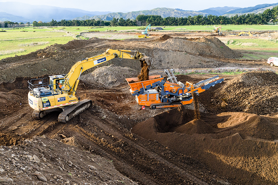
Diggers carting earth to the RX-555 Screening Plant.
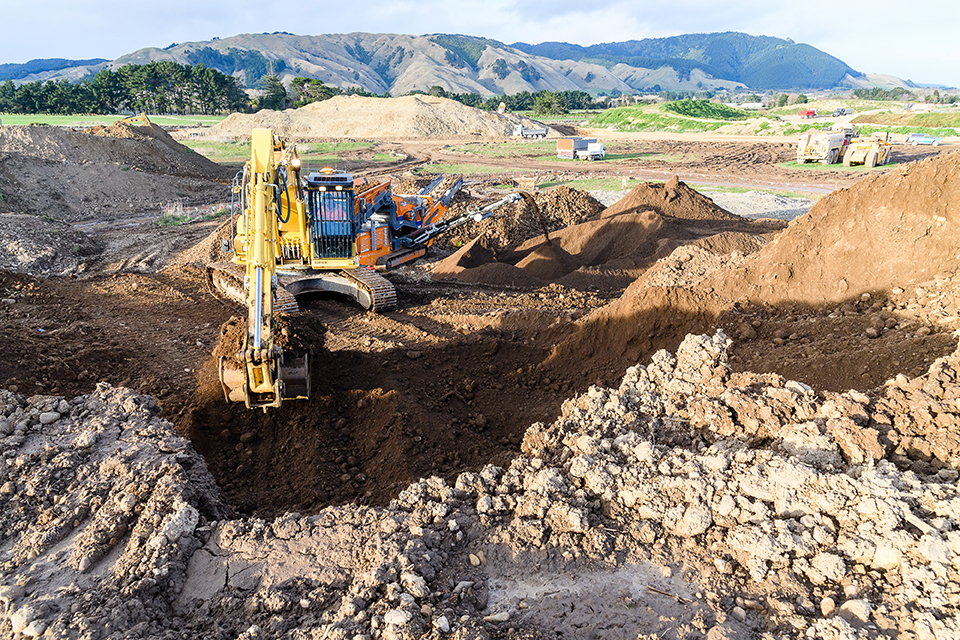
The Winiata Borrow in Te Horo along the PP2Ō Expressway Project.
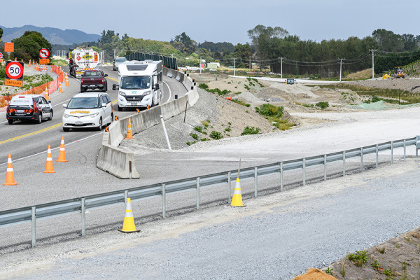
New traffic management truck based in Ōtaki
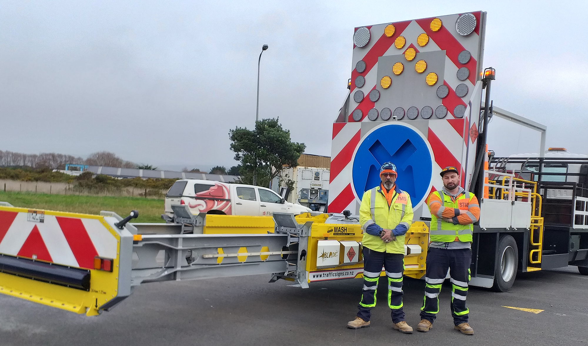
The new traffic management Truck Mounted Attenuator (TMA) Blade Unit with drivers Dennis McSweeney (left) and Shay Moore.
The newest recruit to the PP2Ō team at Ōtaki is the Truck Mounted Attenuator Blade Unit, which is designed to reduce the impact of serious accidents.
The blade at the back of the unit extends for an extra 3 metres than on standard units and can not only absorb the impact of a crash for staff on the truck, but also for the any driver who ploughs into the back of it.
The Blade Unit is rated number 1 in safety against the MASH (Manual for Assessing Safety Hardware) crash testing. The MASH test has been carried out on a range of vehicles, from small light vehicles right through to heavier truck units.
The Blade Unit will be permanently based in Kāpiti.
Upcoming construction milestones
Northern area update
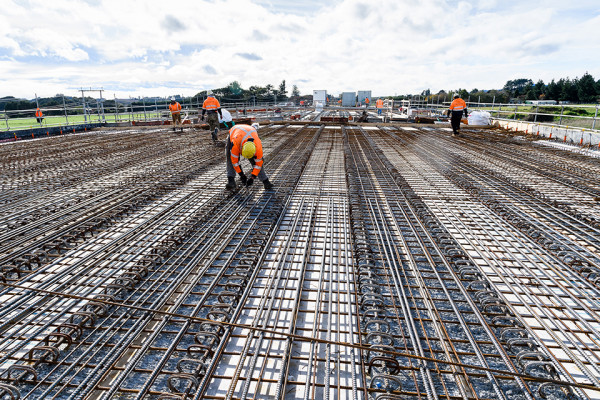
Steel tiers hard at work on Bridge 1 over the Waitohu Stream.
The big push in the northern area of the project is the construction and completion of the new bridge over the Waitohu stream. Progress has been good, with the first deck span poured in late May and the second timed for mid-July. New operational infrastructure at the Winstone quarry was completed and handed over, allowing the project to start constructing the Expressway embankment through the area.
Middle area update
Earthworks continue in the Te Horo Area. Bridge 8 is behind.
Through the central section of the project, the construction of both the new Ōtaki River Bridge and Te Horo Overbridge have progressed well. The construction of Expressway pavements in the central section started in late May, with approximately 3km of pavement sub-base expected to be largely completed by the end of July. Works to the east-west connection between School Rd and Te Horo Beach Rd (eventually using the Te Horo Overbridge when complete) progressed through the period, with the first of the staged realignments expected to be in place by mid-September this year.
Southern area update
Pavement and barrier works are making good progress on the Local Arterial Road Stage 2 at Marycrest.
Works to the main structures in this area (Marycrest Rail Overbridge, the Local Road Underpass and the Shared Path Underpass) have progressed well through the period, with both underpasses expected to be completed by early August. Pavement and barrier works have continued stage 2 of the Local Arterial Road. The switching of all SH1 traffic to this road is now timed for early to mid-October. Once the state highway traffic has been moved, construction of the Expressway between Te Kowhai Rd (in the south) and the Marycrest Rail (in the north) can begin.