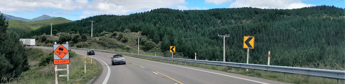
Waka Kotahi NZ Transport Agency is improving safety on State Highway 5 (SH5) from Napier to Taupō. This includes widening the road shoulder, installing roadside safety barriers and rumble strips, painting new lines and a wider centreline to improve the safety at various high-risk curves.
SH5 between Napier and Taupō is a critical link between Hawke’s Bay and the upper North Island.
Planning work is underway to address concerns raised by the community about SH5. The first phase of this, a Programme Business Case, has been endorsed by the Waka Kotahi Board, and funding for the next phase will be sought through the National Land Transport Fund 2024-2027.
In the interim, $13 million has been approved to progress with an immediate programme of works identified by the community and the project team as critical, which is underway. This includes improving the safety of a number of high-risk curves on SH5, as well as the Tarawera slow vehicle bay. Construction started in January 2024 and is due to be complete mid to late 2024.
Safety infrastructure helps save lives and reduces the likelihood and severity of a crash, so everyone can get to where they are going safely.
Roadside safety barriers stop your vehicle before you hit something harder – such as a tree or power pole or a ditch.
Centreline widening gives more space between you and oncoming vehicles to help prevent head-on collisions, while shoulder widening provides you with more space to navigate through and around high-risk curves, reducing the risk of loss of control.
Rumble strips will give you a wake-up call if you’re tired or distracted, as the raised markings make a rumbling sound when driven over.
Find out more about how safety infrastructure works here:
While Cyclone Gabrielle recovery works continue, improving the safety of our roads also remains a priority. These SH5 safety improvements had already been approved before the Cyclone, and Transport Rebuild East Coast (TREC) has capacity to do this work alongside recovery work to help make SH5 safer, more resilient and more reliable overall.

Site Engineer Genald Sebastian (TREC), Supervisor Blair Davis (Hawke's Bay Civil Infrastructure) and Site Traffic Management Supervisor Daniel Bullivant (Traffic Management NZ) onsite as crews start work on shoulder widening on SH5 near Te Pōhue.
We are widening the road shoulder, installing roadside safety barriers and rumble strips (audio tactile profiles), painting new lines and a wider centreline to improve the safety of various high-risk curves on SH5 between Eskdale and Waipunga.
We will also be making safety improvements to the Tarawera slow vehicle bay by removing old lines and re-painting new lines to widen the centreline and road shoulder, as well as installing rumble strips.
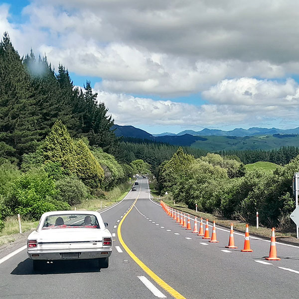
While this work takes place, there will be stop/go traffic controls, traffic reduced to one lane and temporary reduced speed limits of 30km/h to 50km/h.
In addition to safety improvements, TREC is doing repair, rebuild and maintenance work at multiple sites on SH5.
Overall, please expect delays of up to 30-45 minutes across the whole SH5 corridor while the improvements are happening.
If our plans changes because of things such as bad weather we’ll keep you updated. You can follow for updates on www.facebook.com/WakaKotahiHBG(external link)
Safety improvement sites - stop/go and 30km/h to 50km/h traffic management:
Recovery and maintenance sites - stop/go and 30km/h to 50km/h traffic management:
These safety improvements are due to be complete by mid-2024. As work is dependent on variables such as weather, dates may change at short notice. You can stay up to date with the latest information on Journey Planner.
journeys.nzta.govt.nz(external link)
Close