The following videos have been created by NZTA and their consultants to provide detailed information on how the Indicative Route has been identified and how the project will progress through the route protection phase.
Urban design and landscape
Bruce McKenzie speaks of the varying landscapes between Warkworth and Te Hana and how both the Pūhoi to Warkworth section and Warkworth to Wellsford project will ‘stitch together’ to provide continuity of urban design and landscape.
Solid ground for Warkworth to Wellsford
Darryn Wise, Engineering Geologist, discusses the geology of the project area.
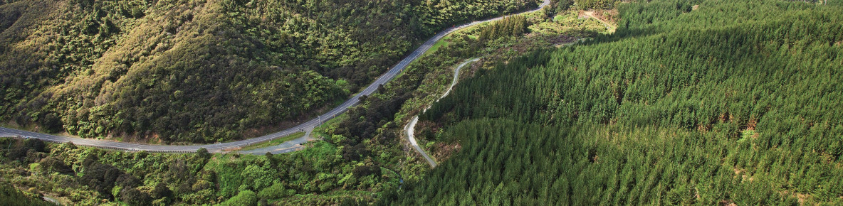
Designing the Indicative Route
Matthew Hawkes, Design Manager, speaks about the design journey to identify the Indicative Route for Warkworth to Wellsford.
Protecting and enhancing our natural environment
Graham Don, Ecologist, speaks of the ecology of Warkworth and Wellsford project area and how environmental values have helped inform the Indicative Route.
Connecting Northland
Paul Glucina, Transport Planning Manager, Auckland and Northland, explains how the Warkworth to Wellsford project fits within the NZ Transport Agency’s Connecting Northland strategy.
Planning and consenting for Warkworth to Wellsford
Karyn Sinclair, Principal RMA Planner, explains the planning and consenting process for Warkworth to Wellsford.
Ara Tūhono – Warkworth to Te Hana indicative route
The indicative alignment for Ara Tūhono – Warkworth to Te Hana connects to the Ara Tūhono – Pūhoi to Warkworth section to the northwest of Warkworth and heads north, crossing Woodcocks and Kaipara Flats Roads.