Last updated: 18 March 2025
Frequently asked questions
How was the project funded?
The construction of the project cost $290m.
The majority (about 87%) of the project was funded by the NZ Transport Agency with funding from the National Land Transport Fund (NLTF) which is collected from fuel excise duty (FED), road user charges (RUC) and vehicle and driver registration and licensing charges. The rest of the project was funded by the Christchurch City Council (CCC). However, not all this funding was from council rates, around 50% of the funding for the CCC section of the CNC project also came from the National Land Transport Fund (NLTF).
How long is the Christchurch Northern Corridor?
The Christchurch Northern Corridor project is about 12km long from the Waimakariri River to the Cranford/Innes Intersection plus another 4km for the QEII Drive four-laning.
When did it open?
The Christchurch Northern Corridor opened to traffic on 17 December 2020.
Did the Christchurch Northern Corridor reduce traffic on Main North Road and Marshland Road?
Yes. With commuters from North Canterbury and North Christchurch and freight traffic using the Christchurch Northern Corridor, traffic volumes on Main North Road and Marshland Road have dropped significantly. This has reduced congestion, improved travel times for all road users and improved amenity for local residents.
Traffic modelling showed that traffic decrease on Main North Road from 27,100 vehicles per day before CNC opened in 2020 to 16,464 vehicles per day after CNC opened in 2021 and traffic decrease on Marshland Road from 14,570 vehicles per day before CNC opened in 2020 to 11,200 vehicles per day after CNC opened in 2021.
Traffic numbers on the CNC were 26,193 vehicles per day in 2024; on Main North Road in that year there were 18,600 and Marshland Road there were 12,100.
How has the Christchurch Northern Corridor affected public transport?
The CNC has made it easier to operate bus services on Main North Road and Marshland Road. New direct bus routes have also been established from Rangiora and Kaiapoi via the CNC to the central city.
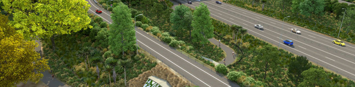
What provision is there for pedestrians and cyclists?
A shared use off-road path was constructed parallel to the Christchurch Northern Corridor from Tram Road to McFaddens Road. The CNC Shared Use Path starts at the Tram Road/Main North Road intersection and runs parallel to the northern motorway. A clip-on path on the Waimakariri Motorway Bridge now takes pedestrians and cyclists over the Waimakariri River. The CNC Shared Use Path (SUP) connects with Main North Road, Guthries Road, Belfast Road, Radcliffe Road, Prestons Road, QEII Drive, Grimseys Road, Winters Road, as well as Owen Mitchell Park and the future ‘Source to Sea’ pedestrian and cycle path along the Styx River. The off-road shared cycle path runs through the Cranford Basin and then along Cranford Street to end at McFaddens Road. From McFaddens Road, an on-road cycle lane has been included on both sides of Cranford Street to Innes Road. A link has also been built to connect the CNC SUP to the Papanui Parallel cycle path.
Is the Christchurch Northern Corridor elevated?
Most of the Christchurch Northern Corridor has been constructed at or near ground level. Overbridges have been constructed so local roads can go over the Christchurch Northern Corridor (Belfast Road, Radcliffe Road and Prestons Road).
How was noise managed?
Low-noise asphalt has been used along most of the new motorway. This is a quieter surface than the chipseal used on many roads. Noise reducing earth bunds, fences and concrete barriers have also be used where possible in areas near housing.
Testing and modelling were used to measure and predict noise levels in the area before any changes were made, and these findings were used to design the noise mitigation for each area of the project. The NZ Standard for Road traffic noise – new and altered roads (NZS 6806:2010) was used.
Will the noise level increase as traffic numbers increase?
Noise increases with vehicle numbers, that’s why mitigations for the motorway were designed with a higher number of vehicles in mind.
What is the speed limit on the Christchurch Northern Corridor?
The speed limit on the Christchurch Northern Corridor is 100km/h between the Waimakariri River and QEII Drive. It reduces to 80km/h at the interchange with QEII Drive.
Are there cameras on the new CNC motorway?
There are 3 different cameras systems on the new CNC Motorway:
Operational CCTV System
The CCTV cameras along the CNC Motorway give almost 100% visual coverage of this new road. This information is used to help crews on the ground and in the Transport Operations Centres help manage traffic during congestion or traffic incidents. The cameras also play a role in the management of the T2 lane.
T2 Lane Cameras
These cameras are used to monitor the T2 lanes and are close enough to the ground to be able to see inside vehicles. These cameras will be used to monitor vehicles travelling in the T2 lanes.
Automatic Number Plate Recognition (ANPR) Cameras
These cameras 'read' the number plates of vehicles at different points along the CNC corridor. This information is used to calculate travel times along the road, and this is then displayed on the journey time signs. Number plates are encoded within the cameras so individual vehicles number plates cannot be retrieved.